
Special Weather Statements Issued for Halton
Published January 29, 2018 at 12:54 pm
If your weekend was filled with lazy days, binge-watching, and involved no pants, that’s perfect.
Because the weekend is over.
If your weekend was filled with lazy days, binge-watching, and involved no pants, that’s perfect.
Because the weekend is over.
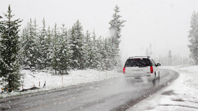
It looks like your commute home on Monday could be sloppy, especially in Oakville and Burlington.
Videos


A pair of special weather statements were issued by Environoment Canada early Monday.
More snow is likely on its way to Oakville, Burlington, Milton, Halton Hills, Mississauga, and Brampton.
But Oakville and Burlington are expected to see total snowfall amounts of 10 to 12 cm beginning this morning.
“A cold front and associated weak low are expected to move slowly across Southern Ontario today,” reads the statement.
“This frontal zone is forecast to become active and generate appreciable snow.”
Snow will start this morning and continue into this evening before tapering off.
Motorists and commuters are being advised to plan for challenging road conditions “especially for the Monday evening commute.”
An earlier statement was issued covering the remaining towns and cities in Halton and Peel, with total snowfall amounts of 5 to 10 cm.
Monday’s predicted high is -2 C with an expected low of -9 C.
Tuesday is expected to see a high of -7 C and dip to -14 C.